Developing effective teaching and learning through Geocaching
Tags: Cross-curricular | Health and physical education | Social sciences | Utilities/tools/gadgets | Lower secondary | Secondary |
Geocaching was used at Papatoetoe High School to strengthen students’ "learning to learn" capabilities, and deepen teachers’ understandings of effective teaching.
"In our school, the curriculum supports students to become capable and discerning users of digital information."
eLPF 2014
What is geocaching?
Geocaching is an outdoor recreational activity where participants go on a hunt to locate containers called "geocaches" or "caches". A Global Positioning System (GPS) or mobile device, and other navigational techniques are used.
Exploring effective teaching in The New Zealand Curriculum
Teaching staff at Papatoetoe High School introduced Geocaching to junior secondary students as one of a number of projects they used to explore characteristics of effective teaching. They used a set of agreed principles to help design the geocaching project.
The design principles:
- Projects should provide interactive, engaging learning activities which strengthen "learning to learn" capabilities.
- Projects should help students make authentic, relevant connections between their learning and the world they live in.
- Outcomes should conclude with an evaluation, using learner-derived indicators of successful learning and opportunities to celebrate achievements.
Other concepts that guided the design and implementation of geocaching were:
- curriculum coherence
- flexible timetables
- emphasis on creativity
- innovation
- problem-solving
- collaboration
- collegiality.
Using geocaching with students
Before the treasure hunt began, students researched the history of geocaching and its uses. They became familiar with different types of caches and strategies for answering clues. The treasure hunt took place over three days.
Day 1: Introduction and street orienteering around the school and local area
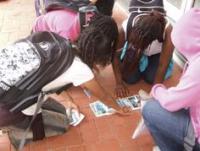
Students worked in groups to find local landmarks. They had to answer clues using an unlabelled map. Each group started at three-minute intervals and teachers were positioned around the course. Students were required to submit text answers and picture messages of certain landmarks. Students spent the remainder of the day familiarising themselves with GPS technology and tools so that they were ready for day two.
Day 2: Geocaching at the Auckland Domain
Staff created and hid geocaches around the Auckland Domain for the students to locate. Students were given 10 geocache locations with hints. Each cache included a code that students would text to staff to identify their location. Students had to find statues and send photographs of themselves posing with the statue. They also had to solve puzzle caches and text in their answers.
Day 3: The Amazing Race
The final day was set up like "The Amazing Race" with activities that took students around North Head and downtown Auckland. The same technology was used as in previous days, but new terrain and more difficult clues provided a challenging, competitive, and engaging climate.
Outcomes for staff and students
Planning and participating in this project provided many opportunities for staff to think differently about teaching and learning. Teachers began to establish a shared understanding of effective teaching strategies and a growing interest in how to model key competencies in their learning programmes.
Students had opportunities to develop key competencies as they became actively engaged in the project.
Thinking
- Students used creative, critical, and metacognitive processes to interpret the maps, GPS coordinates, and puzzles.
Using language, symbols, and text
- Students read a range of texts (written, visual, mathematical, technological) to make meaning of codes and clues. They were confident users of GPS technology and mobile phones as they accessed and provided information, and communicated with others.
Managing self
- Students displayed a can-do attitude as they traveled between locations, often ahead of the allocated time estimated by teachers. They were reliable and resilient during the project.
Relating to others
- Students worked effectively with each other. They negotiated between themselves to identify individual and group strengths and nominated who would take responsibility for different roles.
Participating and contributing
- Students made connections with each other and contributed appropriately as group members. While they were aware of the competitive nature of the challenges, they also protected each other and supported all teams.
Handy hints
- When planning geocaching exercises make sure that you identify possible risks and put in place safety action plans .
- Students tend to follow straight lines and do not always look for tracks and safe pathways such as footbridges and pedestrian paths. Choose your routes carefully.
- Ensure that students have access to a mobile phone and know emergency contact numbers if they become lost or hurt.
- Collect feedback from students at the end of each day to help with future planning.

